


)
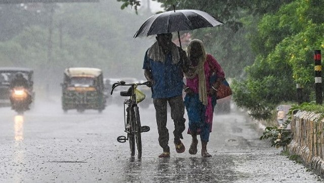

Monsoon will withdraw from for this year soon. AFP
The four-month journey of Monsoon 2022 is on its last phase as on Tuesday Indian Meteorological Department announced the commencement of monsoon withdrawal from the western parts of the country.
As per IMD, Southwest Monsoon has withdrawn from parts of southwest Rajasthan and adjoining Kutch on 20 September, 2022 against its normal date of withdrawal from southwest Rajasthan of 17 September.
The line of withdrawal of Southwest Monsoon passes through Khajuwala, Bikaner, Jodhpur and Naliya.
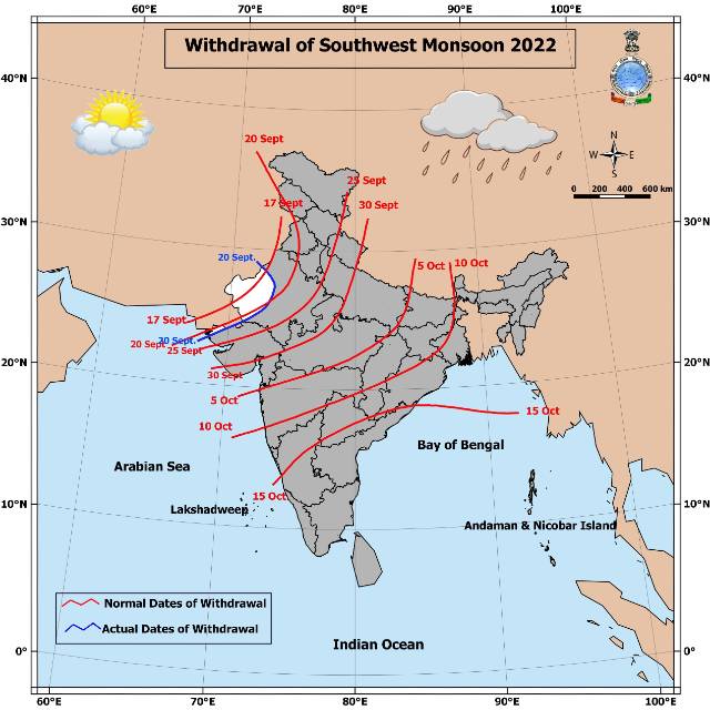
Line of Monsoon withdrawal as per India Meteorological Department
How is the monsoon withdrawal declared? Let’s look at the conditions:
• Like the onset criteria, the criteria for the withdrawal of monsoon have also undergone changes. The current operational criteria used by IMD for declaring the withdrawal from extreme north-western parts of the country was adopted in 2006 and consist of the following major synoptic features which will be considered only after 1st September.
i) Cessation of rainfall activity over the area for continuous 5 days.
ii) Establishment of anticyclone in the lower troposphere (850 hPa and below)
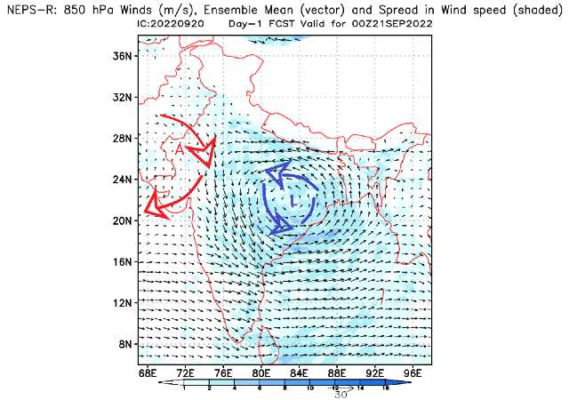
Anticyclonic circulation over west Rajasthan and Low pressure area over east Madhya Pradesh as on 21 September
iii) Considerable reduction in moisture content as inferred from satellite water vapour imageries and tephigrams.
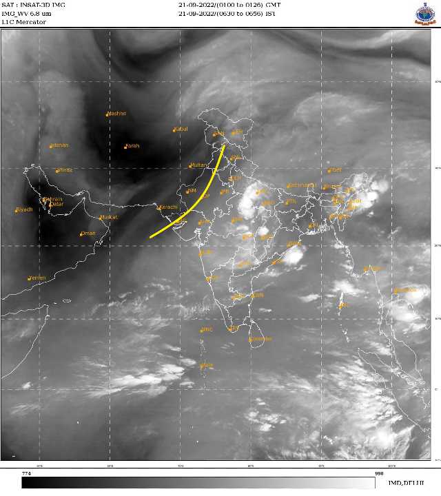
Reduction in moisture content over west Rajasthan as on 21 September water vapour satellite imagery
- Further withdrawal from the country is declared keeping the spatial continuity, reduction in moisture as seen in the water vapour imageries and prevalence of dry weather for five days. SW monsoon is withdrawn from the southern peninsula and hence from the entire country around 15th October, when the circulation pattern indicates a change over from the south-westerly wind regime.All the parameters are satisfactory for the declaration of the monsoon withdrawal from the western Rajasthan and parts of Kutch as on 20th September, hence it is declared by the Official agency.
The performance of Pan-India rainfall in the south west monsoon 2022 so far till 20th September:
• India as a whole recorded a total of 878.5mm rainfall against the average of 822.0mm, a departure from normal stands at +7 per cent
Subdivision wise seasonal rainfall figures:
• Southern Peninsula: Actual 844.7mm against the average of 661.0mm, +28 per cent departure from normal.
• East & North East India: Actual 1062.1mm against the average of 1278.5mm, -17 per cent departure from normal.
• North West India: Actual 540.3mm against the average of 565.7mm, -4 per cent departure from normal.
• Central India: Actual 1120.1mm against the average of 933.9mm, +20 per cent departure from normal.
Current Synoptic features influencing weather in India as on 21st September:
• The withdrawal line of Southwest Monsoon continues to pass through Khajuwala, Bikaner, Jodhpur and Naliya.
•The Low Pressure Area over north Chhattisgarh and neighbourhood now lies over northeast Madhya Pradesh and neighbourhood with associated cyclonic circulation extending up to 5.8 km above mean sea level tilting southwestwards with height. It is very likely to move west-northwestwards during next two days.
• A trough runs from northwest Bay of Bengal to north Punjab across north Odisha, north Chhattisgarh, cyclonic circulation associated with Low Pressure Area over northeast Madhya Pradesh and neighbourhood, Haryana and extends up to 3.1 km above mean sea level.
• The trough from north Chhattisgarh and neighbourhood to north Punjab across West Uttar Pradesh, northeast Rajasthan and Haryana between 1.5 km to 3.1 km above mean sea level has merged with the above trough.
• The Western Disturbance as a trough in mid-tropospheric westerlies with its axis at 5.8 km above mean sea level roughly along Long. 67°E to the north of Lat. 28°N persists.
Monsoon withdrawal will be on hold for this week
The presence of low pressure area over North East Madhya Pradesh and the axis of monsoon is active over the plains of North India.
Moisture incursion is taking place from the Arabian sea towards the northwest India.
Due to the combination of the multiple weather system widespread moderate to heavy rains are expected across Madhya Pradesh, Uttar Pradesh, Delhi NCR, Haryana, Punjab, Uttarakhand, Himachal Pradesh, Jammu Kashmir and eastern parts of the Rajasthan from Wednesday and it will last fairly till the weekend.
The current spell of monsoon rains will also decrease the rainfall deficiencies in the northern states of the country and potentially a major drop in day temperatures will be observed, meanwhile, the further withdrawal of monsoon is not expected at least before next week.
The author, better known as the Rohtak Weatherman, interprets and explains complex weather patterns. His impact-based forecasts @navdeepdahiya55 are very popular in north India.
Read all the Latest News, Trending News, Cricket News, Bollywood News,
India News and Entertainment News here. Follow us on Facebook, Twitter and Instagram.
More News
For Nitish, a lot at stake as 5 seats vote | India News – Times of India
Supreme Court To Pronounce Verdict On Pleas Seeking Mandatory EVM-VVPAT Cross-Verification Today
BJP swept Rajasthan in last 2 polls, but a hat-trick may not come easy